MyTopo Maps Review
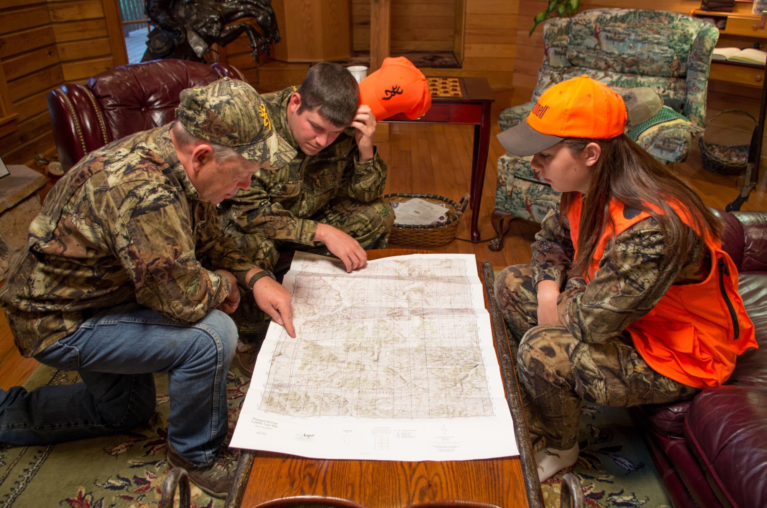
As long as I can remember I’ve loved maps. I can spend hours pouring over the details of a map trying to learn a new area or revisiting a favorite one. Today that is largely done on Google Earth or using my onX Hunt app. However, in this electronic age, there’s still a place and a need for physical printed maps. For the backcountry hunter, I believe that MyTopo offers a truly exceptional printed map for hunting. Here’s a quick review of MyTopo Maps for hunters and a few ways that I use them.
Overview
MyTopo began in 1998 with the goal of providing custom printed maps for professional and recreational topographic map users. In addition to producing hundreds of thousands of custom topographic, satellite, and aerial photograph map products, they support Internet-based map services and maintain data and software supporting a wide variety of consumer and professional users.
Today MyTopo’s most popular map products are:
- United State Geological Survey (USGS) 7.5 topographic maps (order by the USGS quad )
- Custom Aerial Maps of any place in the US or Canada
- Public land hunting maps, including Game Management Unit Maps for the West or Wildlife Management Areas for the Eastern US
MyTopo can overlay private land boundaries to provide landowner names and parcel boundaries on its topos or satellite maps. In addition to private land data, customers can add public land boundaries, US Forest Service Roads and Trails, and GMU boundaries.
How I use MyTopo Maps:
GMU Maps
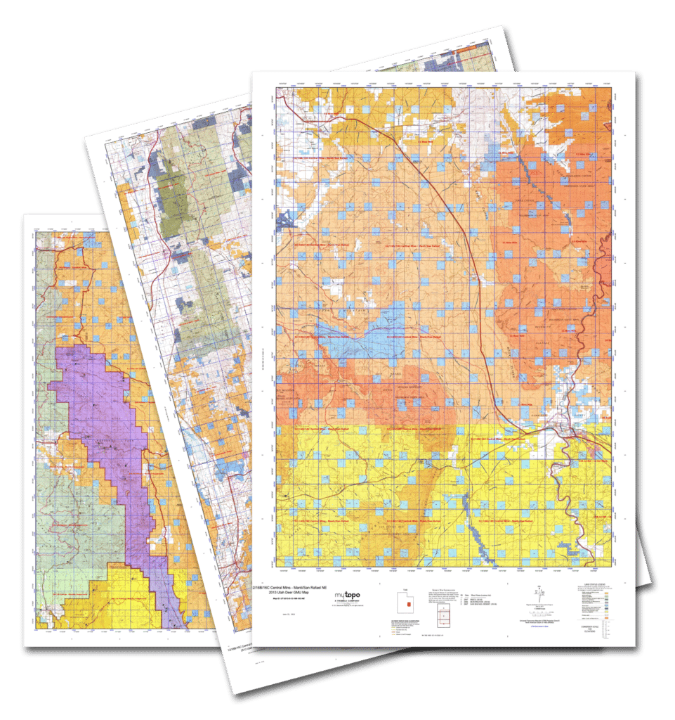
I have GMU maps of every area that I hunt or plan to hunt. One feature of MyTopo that I really like is you can easily find the map of the GMU or hunt area that you’re interested in, and preview the map online. You can customize your map with a variety of options and then place your order. I generally receive maps in about a week. When I’m hunting my GMU map and compass ride shotgun in my bino harness.
Custom Aerial Photo or Satellite Imagery Maps
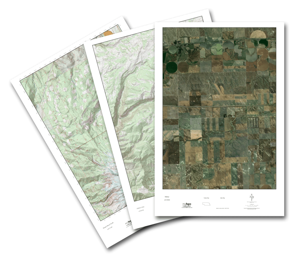
If you’re a landowner, you can purchase a custom printed aerial view of your land. I’ve shown up in several hunting camps that use a custom aerial photo or satellite image maps to show new hunters the lay of the land, property boundaries and even stand locations. The custom maps and GMU maps are printed on waterproof paper for use in the field. Maps can also be laminated for use with a dry erase marker. My elk hunting partner likes to buy the both the GMU topographic map and the aerial photo map of the area we’re hunting and have them laminated them back to back for use in base camp.
Plan B
I’m a big fan of my onX Hunt app and use the iPhone and desktop application extensively. For me, my onX Hunt app and my MyTopo printed maps really complement each other. There is something about spreading out a printed map to give you the lay of the land that at least for me cannot be replaced digitally. Plus, technology fails. If I lose my iPhone in the middle of nowhere, I can still find my way home with my map and compass. I would suggest that you always have a couple of ways to navigate with you any time you’re in the backcountry.
To learn more or place an order, visit www.mytopo.com.