
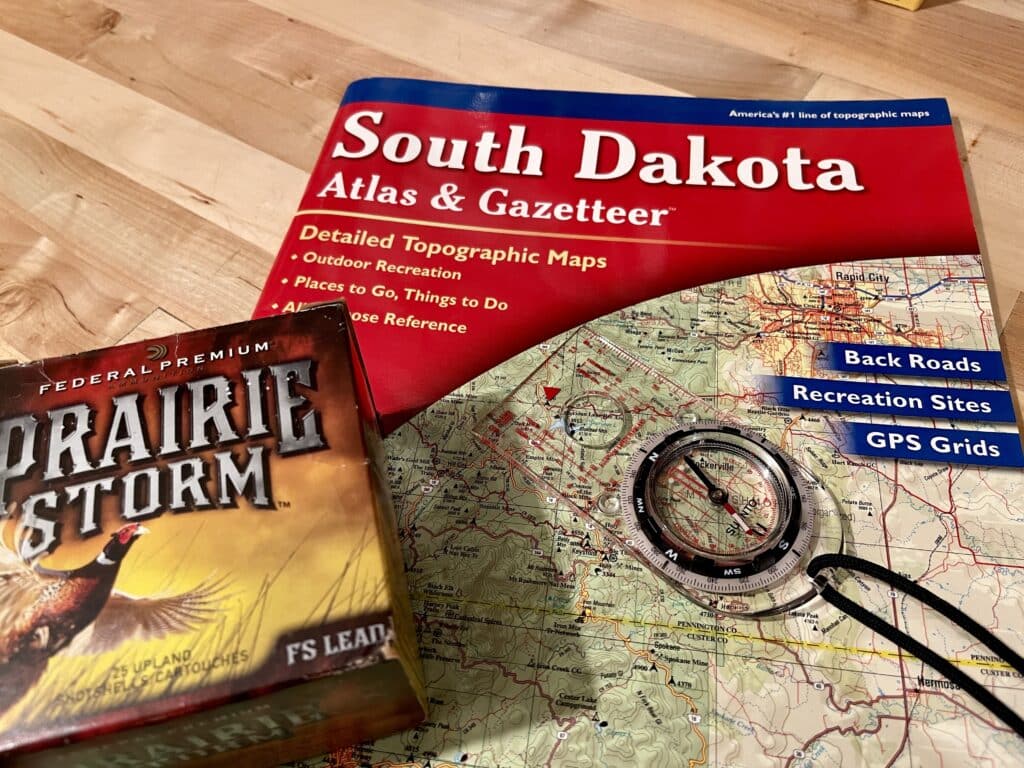
Pheasant Hunting Success with onX Hunt: Tips, Strategies, and Features
My vision of heaven is walking a grassy draw on a sunny day. I am following my Brittany with a fine shotgun in my hand. My girl locks on point as we close to the draw’s end. I walk ahead of her, and two gaudy roosters explode cackling from the grass before me. I could do that for all eternity. Pheasant hunting is that special. Down here on earth, pheasant hunting often comes with one major challenge: finding quality land to hunt. Before the days of digital mapping tools like onX Hunt, hunters relied on paper maps, plat books, and word-of-mouth recommendations. Locating hunting spots and navigating public and private land boundaries was challenging. In this article, we’ll explore how onX Hunt can help you take your pheasant hunting to the next level.
The Struggle of Finding Land Access
Before GPS-enabled hunting apps like onX Hunt became available, pheasant hunters faced a common problem: identifying where they could legally hunt. Finding access to land was often a labor-intensive process that required pouring over outdated paper maps and plat books. These resources were often inaccurate, lacking updated boundary lines or omitting key information like land ownership changes.
How onX Hunt Solves the Land Access Challenge
onX Hunt completely revolutionizes how hunters access land. GPS technology and detailed mapping systems allow users to find public and private land boundaries easily.
With onX Hunt, there’s no need for bulky plat books or confusing paper maps. Everything is at your fingertips. You can identify whether the land is privately owned, state-managed, or part of a walk-in hunting area and then use it to navigate directly to your chosen hunting spot with GPS precision. The app’s offline capabilities also allow hunters to download maps ahead of time, so they can continue navigating even in areas without cell service.
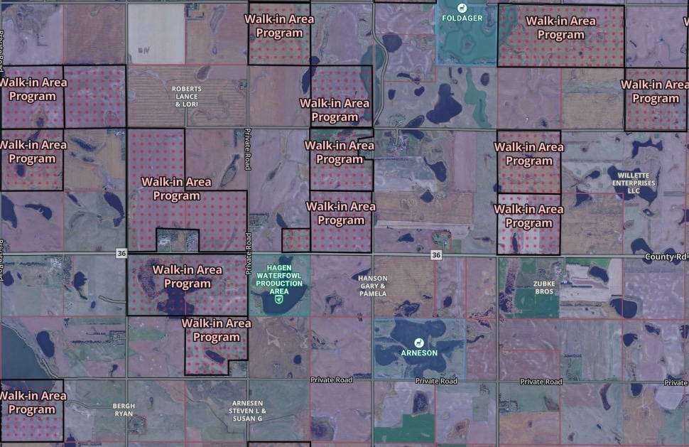
Finding Walk-In Areas and Prime Hunting Spots with onX Hunt
One of the most valuable features of onX Hunt for pheasant hunters is its ability to help you locate walk-in hunting areas. Walk-in areas are typically privately owned lands where landowners allow public hunting, often managed through state or federal programs. These spots are the next best thing to private land access and can offer some solid pheasant hunting opportunities, but finding them without the right tools can be tricky.
onX Hunt allows easy identification of walk-in areas on the map by turning on this view in the Layer Library in the app or website. If I’m planning a trip, I like to scout the area on the large screen of my desktop computer, identify areas where there are a concentration of several areas to hunt within close vicinity, and then mark them on the map with a waypoint. I typically will mark areas that I plan to hunt with a green waypoint marker, and then after I hunt the area, if I see birds there, I will switch the color to red as my indicator that it is a good spot.
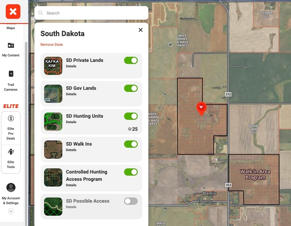
Using the Layer Library to Elevate Your Hunting Strategy
The onX Hunt app’s Layer Library is a game-changer for fine-tuning your pheasant hunting strategy. The Layer Library offers a variety of options that you can overlay on the map to get detailed information specific to your hunting needs.
Some essential layers for pheasant hunters include:
- Walk-In Areas: This layer shows private lands open to public hunting, making it easy to find spots where pheasant hunting is permitted.
- Public Land Boundaries: Identify state and federal land where hunting is allowed.
- Private Landowner Names: If you want to contact landowners for permission, this layer helps by showing who owns specific parcels.
- Crop Data: Finding land that has crops adjacent or nearby will dramatically increase your odds of seeing birds!
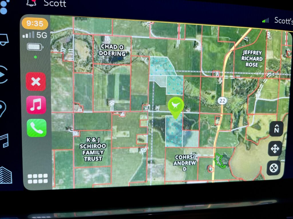
CarPlay and Android Auto: Elevating Your onX Hunt Experience
One of the most exciting features onX Hunt has introduced is its integration with Apple CarPlay and Android Auto. This integration takes the powerful features of the app to a whole new level by allowing you to view maps, layers, and data directly on your vehicle’s large infotainment screen.
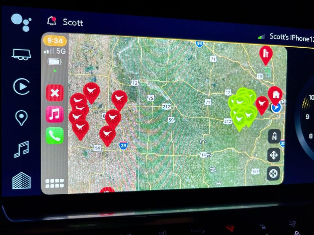
Here’s how this benefits your pheasant hunting:
- Large Screen Navigation: Instead of squinting at your phone screen, you can now see the full layout of your hunting maps on your truck’s dashboard. This makes it easier to spot key features like walk-in areas, public land boundaries, and hunting zones in real-time, without the distraction of holding your phone.
- Hands-Free Navigation: Safety and convenience are key while hunting, especially when navigating unfamiliar backroads or terrain. With onX Hunt displayed on your vehicle’s screen through CarPlay or Android Auto, you can drive hands-free while keeping an eye on your hunting areas.
- Enhanced Offline Capabilities: When you’ve pre-downloaded your maps for offline use, those maps are still accessible on your truck screen even in remote areas with poor cell service. This gives you an uninterrupted view of your hunting route and access points.
Whether you’re driving to a new location or scouting potential spots on the fly, the ability to view the app on a large screen in your vehicle brings a new level of ease and efficiency to your hunt. You no longer have to fumble between different devices or worry about missing key landmarks or access points.
Pro Tip: Be sure to regularly check the Layer Library for new layers. onX is constantly adding new features!
Customizing Maps for Offline Use
Another major advantage of onX Hunt is the ability to download maps for offline use. Since many of the best hunting spots are in rural areas with poor cell service, having access to an offline map is crucial. With onX Hunt, you can download high-resolution maps that include all your saved waypoints, tracks, and custom layers. This ensures that you always have access to critical land information and hunting data, even when your phone signal drops out. Select your hunting areas, save the necessary maps, and head out fully prepared.
Conclusion: Enhance Your Pheasant Hunting with onX Hunt
Your options for hunting pheasants have greatly expanded thanks to the powerful features of onX Hunt. With precise land boundaries, access to walk-in hunting areas, customizable map layers, and the ability to view it all on your truck’s large screen, hunters can now spend less time worrying about where they’re allowed to hunt and more time focusing on the hunt itself.
Now, it’s your turn. Download onX Hunt, connect it to your vehicle’s screen, and get ready to get on more pheasants!
Related Content: The Ultimate Pheasant Hunting Gear List
Note: At this writing, onX Hunt is a sponsor of HuntTested. HuntTested may receive a small commission if you purchase a product from the links on this page. HuntTested may have received product consideration in coordination with this article. All opinions belong to HuntTested.